Petrographical Office Wellsite Evaluation and Reporting
Power*Log is our comprehensive, vertical geological chip and rudimentary core logging software that has revolutionized the way geological information is currently captured and utilized. It has been designed for both the office and the wellsite personnel, enabling geoscientists to make timely and informed exploration and development decisions.
The architecture of Power*Log is built around a relational database management system (RDBMS) where pertinent data is captured and stored to facilitate data manipulation. Furthermore, the Power*Suite database has been strategically designed to be ODBC (Open Database Connectivity) compliant. This enables third party programs supporting the ODBC interface to work directly with our database in a client-server and heterogeneous environment.
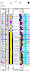
Power*Log has over 100 tracks / layers (data types) to choose from. It can display any or all of your geological information represented on a depth basis. It has the ability to offset some or all of your data for depth correcting to Wireline logs or for misplaced singles while drilling the well. The user also has the ability to sidetrack easily to a specific depth to keep the original well and then add the new data from the side track depths. The user has the ability to add or revise the geological symbols to meet their specific needs. On top of all the geological striplog information the user enters the data once and is then utilized to create Morning and end of well reports for different information that has been gathered along the way. Once the striplog is finished you simply click a button to print the end of well reports to make a comprehensive geological report. With the database the information is mixed and matched to create a real time savings and no need for double entry of data into another reporting tool.
Also the database comes into play for making different logs. You can think of a log as a way to display the wells data. You can create different logs to display the data and the information will only have to be entered once. For instance you could have a wellsite geological striplog, a composite log with the some of the geological data and all the Wireline data. The Cores are regenerated on a different scale on the tail of the main log along with along with formation tops. The Header is printed with the Survey views, a location map and can be printed to any windows compatible printer device. New in 2016 is the ability to print to a tiff file that is a seamless single sheet to be printed or incorporated into other geological applications.

Power*Log is an integrated system that consists of a log editor as well as data transfer and reporting modules. It is complimented by the LAS Modules, the Survey*View module, the TVD module and now the real time data acquisition module which we call Power*WITS. .It implements single entry data that greatly reduces the work load of wellsite geologists compiling comprehensive geological wellsite data, while ensuring a higher level of data standardization. Finally, it will produce timely, consistent and co-relatable data from user to user and well to well cutting the time necessary to make informed decisions and the costs associated with making those decisions:
Power*Log 2016 has these features and benefits you currently enjoy plus more. Such as:
For all our tracks and layers visit our Tracks page.